
Mgahinga Gorilla National Park: Difference between revisions
No edit summary |
No edit summary |
||
| Line 145: | Line 145: | ||
|5.1.1 Subsistence bushmeat hunting | |5.1.1 Subsistence bushmeat hunting | ||
|Present (unknown severity) | |Present (unknown severity) | ||
|Local people still consume bushmeat whenever they get a chance, as reported | |Local people still consume bushmeat whenever they get a chance, as reported (Steven J.B pers. comm. 2026). | ||
|1990-Ongoing (2026) | |1990-Ongoing (2026) | ||
|- | |- | ||
| Line 346: | Line 346: | ||
= Challenges = | = Challenges = | ||
One of the major challenges reported concerns the Batwa community that previously lived within the park. While in Bwindi many of those evicted were resettled just outside the park and have integrated with surrounding communities through empowerment groups, the situation in Kisoro and Mgahinga is starkly different. Here, the Batwa were never resettled in any recognizable way. According to the District Health Education Officer, many of them are still struggling to integrate with other local communities and continue to live in poor conditions (Steven J.B pers. comm. 2026). | |||
'''Table 5. Challenges reported for Mgahinga Gorilla National Park''' | '''Table 5. Challenges reported for Mgahinga Gorilla National Park''' | ||
Revision as of 09:46, 11 June 2026
East Africa > Uganda > Mgahinga Gorilla National Park
Français | Português | Español | Bahasa Indonesia | Melayu
Summary
- Mountain gorillas (Gorilla beringei beringei) are present in Mgahinga Gorilla National Park.
- The population size in the park is unknown; however, the site is part of the larger Virunga Massif, where a population size of 669 (CI: 623–759) individuals was estimated for 2016.
- The population trend is increasing.
- The site has a total size of 33.7 km².
- Key threats to gorillas are hunting and habitat encroachment due to farming activities.
- Conservation activities have focused on eco-tourism, demarcation and reinforcement of the park’s boundaries, education activities and patrols.
-
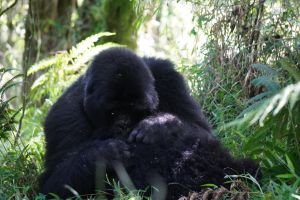
© I. Ordaz-Nemeth -
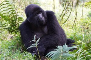
© I. Ordaz-Nemeth -
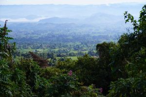
View from Mgahinga Gorilla National Park © I. Ordaz-Nemeth


Site characteristics
Mgahinga Gorilla National Park is located in the southwestern corner of Uganda, bordering Rwanda to the south and DRC to the west. The park derives its name from "Gahinga," a local term referring to the volcanic stones cleared from farmland at the base of the volcanoes. Originally declared a game sanctuary by the British administration in 1930, it was officially designated as a National Park in 1991 (Uganda Wildlife Authority).
The park is home to a single habituated transboundary gorilla group. Situated at altitudes ranging from 2,227m to 4,127m, Mgahinga Gorilla National Park was established primarily to safeguard the mountain gorillas. It also serves as a critical habitat for the endangered golden monkey. In addition to its wildlife significance, the park holds immense cultural importance, particularly for the indigenous Batwa people (Uganda Wildlife Authority).
Mgahinga's most prominent features are its three conical, extinct volcanoes, a part of the breathtaking Virunga Range. As part of the larger Virunga Conservation Area, encompassing neighboring parks in these countries, the slopes of these volcanoes host diverse ecosystems and a rich array of biodiversity. Over 76 mammal species, including elephants, giant forest hogs, bush pigs, bushbucks, buffalos, and leopards are found in the site. The park also boasts a bird checklist of over 180 species, including 14 endemic to the Albertine Rift, notably the Kivu ground thrush and turaco (Uganda Wildlife Authority).
Table 1. Basic site information for Mgahinga Gorilla National Park
| Species | Gorilla beringei beringei |
| Area | 33.7 km² |
| Coordinates | Lat: -1.370292 , Lon: 29.632708 |
| Type of site | Protected area (National Park) |
| Habitat types | Subtropical/tropical moist montane forest |
| Type of governance |
Types of sites Governance types Habitat types
Ape status
The exact number of individuals inhabiting the site is unknown. The park is part of the larger Virunga Massif, where the total population was estimated to be 669 (CI: 623–759) individuals in 2016. It was also estimated that the growth of the entire Virunga Massif population was 3.0% (CI: 2.5–3.4%) or 3.1% (1.4–4.3%) per year between 2010 and 2016 (Granjon et al. 2020).
Table 2. Ape population estimates reported for Mgahinga Gorilla National Park
| Species | Year | Occurrence | Encounter or vistation rate (nests/km; ind/day) | Density estimate [ind./ km²] (95% CI) | Abundance estimate (95% CI) | Survey area | Sampling method | Analytical framework | Source | Comments | A.P.E.S. database ID |
|---|---|---|---|---|---|---|---|---|---|---|---|
| Gorilla beringei beringei | Mgahinga Gorilla National Park | ||||||||||
| Gorilla beringei beringei | 2016 | 669 (623-759) | Virunga Massif, including Mgahinga | Unknown | Granjon et al. 2020 |
Sampling methods Analytical frameworks
Threats
Before the establishment of the protected area, several human activities were impacting wildlife inhabiting the site, particularly livestock grazing, farming and hunting. In the course of 1992, all settlers left the deforested zone of the national park and most of these activities stopped. 221 farms were moved and the settlers received compensation payments (Karlowski 2004).
Table 3. Threats to apes reported for Mgahinga Gorilla National Park
| Category | Specific threats | Threat level | Description | Year of threat |
|---|---|---|---|---|
| 1 Residential & commercial development | 1.1 Residential areas | High (more than 70% of population affected) | Until 1992, people lived in what is now the protected area, where they farmed, logged and hunted (Karlowski 2004). | 1992 |
| 10 Geological events | 10.2 Earthquakes/tsunamis | Present (unknown severity) | Unknown | |
| 2 Agriculture & aquaculture | 2.1.1 Shifting agriculture | High (more than 70% of population affected) | In 1992, the wheat fields inside the national park were harvested for the last time. After a year, the gorillas had extended their habitat to include about 80% of that area (Karlowski 2004). | 1992 |
| 2 Agriculture & aquaculture | 2.3 Livestock farming & ranching | High (more than 70% of population affected) | Livestock grazing in the site; settlers moved out along with 221 farms in 1992 (Karlowski 2004). | 1989-1992 |
| 5 Biological resource use | 5.1 Hunting & collecting terrestrial animals | High (more than 70% of population affected) | Before conservation activities started, there was poaching in the area and hundreds of wire snares on paths to catch antelopes (Karlowski 2004). | 1990 |
| 5 Biological resource use | 5.1 Hunting & collecting terrestrial animals | Low (up to 30% of population affected) | Unintentional effect on gorillas as snares are set targeting other animals in the forest (Hickeys et al. 2019). | 2019-Ongoing (2024) |
| 5 Biological resource use | 5.1.1 Subsistence bushmeat hunting | Present (unknown severity) | Local people still consume bushmeat whenever they get a chance, as reported (Steven J.B pers. comm. 2026). | 1990-Ongoing (2026) |
| 5 Biological resource use | 5.1.5 Persecution/human wildlife conflict | Present (unknown severity) | Human-wildlife conflicts arise due to crop raiding and the lack of compensation, as reported by local communities (Steven J.B pers. comm. 2026). | 1990-Ongoing (2024) |
| 5 Biological resource use | 5.3 Logging & wood harvesting | Present (unknown severity) | Habitat loss due to firewood and bamboo harvesting (Twinomugisha & Chapman 2006). | 2006-Ongoing (2024) |
| 6 Human intrusions & disturbance | 6.2 War, civil unrest & military exercises | Present (unknown severity) | During the civil war parts of Mgahinga National Park sometimes served as retreat areas for paramilitary units. Parts of the afro-alpine vegetation on the peaks of Mt. Gahinga and Muhavura were destroyed during the civil war (Karlowski 2004). | 1990-1994 |
| 7 Natural system modifications | 7.1 Fire & fire suppression | Low (up to 30% of population affected) | In 1989 and 2009, fire broke out along the slope of Mount Muhabura twice caused by human activities in the past and burned a large area from low to high elevation which include small portions of the Mgahinga Gorilla National Park (Hoek et al. 2023; McNeilage 1995). | 1989-Ongoing (2024) |
| 8 Invasive & other problematic species, genes & diseases | 8.1 Invasive non-native/alien species | Low (up to 30% of population affected) | Black wattle (Acacia mearnsii) and Eucalyptus trees were found to be the most widely distributed and Pinus patula the least distributed species in the park. | 1991-Ongoing (2024) |
| 8 Invasive & other problematic species, genes & diseases | 8.4 Pathogens | High (more than 70% of population affected) | Risk of acquiring Covid-19 due to presence in the surrounding human population (Kungu et al. 2023). Evidence of human respiratory viruses, gastrointestinal parasites, and herpes viruses in the Virunga gorilla population exists. In addition, rabies, Ebola, and Marburg virus outbreaks occur in close proximity to the park (e.g. Mazet et al. 2020; Hassell et al. 2017; Smiley Evans et al. 2017; Petrzlkova et al. 2021, 2022). | 2017-Ongoing (2026) |
Conservation activities
In December 1989, a conservation initiative focusing on gorillas and nature was initiated in the site. Biologist Klaus-Jürgen Sucker spearheaded the development of this project, receiving support from organizations such as the German Society for the Protection of Animals (Deutscher Tierschutzbund), the Berggorilla & Regenwald Direkthilfe, and subsequently, from the Center for International Migration (CIM) (Karlowski 2004).
Mgahinga Gorilla National Park was gazetted in 1991; the park’s infrastructure was established in 1993. This included relocating the guard post to the park's new boundary and demarcating the northern boundary with 180 cement cairns spread across 14 kilometers. While these cairns clearly defined the boundary, they left adjacent fields vulnerable to grazing by wildlife. To address this issue, a hedge of Erythrina abyssinica was planted along the park's boundary (Karlowski 2004).
More recently, approximately 38,100 Erythrina trees were planted along the stone wall in Mgahinga Gorilla National Park, spanning a distance of 12.7 kilometers from the Rwanda border to points along the border with DRC. This effort, led by IGCP’s Water4Virungas project in partnership with local communities and the Uganda Wildlife Authority, aimed to mitigate conflicts caused by problem animals such as buffalos. The project sought to enhance park-community relations while reducing crop raids (Nakayima 2021).
Eco-tourism was inaugurated in August 1993, initially offering activities such as mountain trekking, cave exploration, and hiking along nature trails. The range of tourist activities expanded in 1994, with the introduction of visits to the Nyakagezi group, a gorilla population known for migrating between the Ugandan and Congolese sectors of the Virunga Conservation Area (Karlowski 2004).
Even before official gorilla tourism commenced in Mgahinga Gorilla National Park, a revenue-sharing system was established for communities residing near the park. Under this system, 20% of the income generated from park entrance fees was earmarked for community projects, such as the construction of schools or storage facilities. This approach has since become a fundamental aspect of Uganda Wildlife Authority (UWA) policies for all reserves across the country (Karlowski 2004).
Table 4. Conservation activities reported for Mgahinga Gorilla National Park
| Category | Specific activity | Description | Implementing organization(s) | Year of activity |
|---|---|---|---|---|
| 1 Development impact mitigation | 1.3 Prohibit (livestock) farmers from entering protected areas | Several farms were moved out of the park after its establishment, allowing for the regeneration of vegetation (Karlowski 2004). | 1992-Ongoing (2024) | |
| 2 Counter-wildlife crime | 2.11 Implement monitoring surveillance strategies (e.g., SMART) or use monitoring data to improve effectiveness of patrols | Ranger patrol teams are equipped with SMART installed on Android devices | Uganda Wildlife Authority, International Gorilla Conservation Programme | 2023-Ongoing (2024) |
| 2 Counter-wildlife crime | 2.13 Provide sustainable alternative livelihoods; establish fish- or domestic meat farms | IGCP worked with the Uganda Wildlife Authority (UWA) to develop a revenue sharing program and policy and established mechanisms for its application around Mgahinga Gorilla National Park. Managed by committees including local community representatives and UWA officials, the scheme is used to fund projects for the benefit of communities living alongside the gorilla habitat. Training has been provided in ecotourism and tourist-based enterprise development in conjunction with the Uganda Community Tourism Association. | Uganda Wildlife Authority, International Gorilla Conservation Programme | 1995-Ongoing (2024) |
| 2 Counter-wildlife crime | 2.3 Conduct regular anti-poaching patrols | Rangers conduct patrols (Karlowski 2004). | Uganda Wildlife Authority | 1989-Ongoing (2024) |
| 2 Counter-wildlife crime | 2.6 Regularly de-activate/remove ground snares | Rangers conduct patrols and remove snares | Uganda Wildlife Authority | 1989-Ongoing (2024) |
| 2 Counter-wildlife crime | 2.7 Provide better equipment (e.g., guns) to anti-poaching ranger patrols | Ranger patrol teams include one person with a gun and the team is equipped with SMART installed on Android devices | Uganda Wildlife Authority, International Gorilla Conservation Programme | 2023-Ongoing (2024) |
| 2 Counter-wildlife crime | 2.8 Provide training to anti-poaching ranger patrols | Ranger teams receive training programs (e.g. usage of SMART) | Uganda Wildlife Authority, International Gorilla Conservation Programme | Ongoing (2024) |
| 3 Species health | 3.1 Wear face-masks to avoid transmission of viral and bacterial diseases to primates | Facial masks were implemented when COVID-19 pandemic broke out and has been since maintained. | Uganda Wildlife Authority, Gorilla Doctors | 2020-Ongoing (2024) |
| 3 Species health | 3.11 Implement continuous health monitoring/permanent vet on site | The health of habituated gorillas are daily monitored by field teams and sick/injured gorillas are treated after being assessed. | Uganda Wildlife Authority, Gorilla Doctors | Ongoing (2024) |
| 3 Species health | 3.12 Detect & report dead apes and clinically determine their cause of death to avoid disease transmission | Demographic changes such as deaths (or missing gorillas which may indicate death) are reported through daily monitoring of habituated gorilla groups. Encounters of dead gorillas outside groups are also reported. All dead gorillas are removed from the forest for necropsy if possible. | Uganda Wildlife Authority, Gorilla Doctors | Ongoing (2024) |
| 3 Species health | 3.13 Implement a health programme for local communities | In the Bwindi Mgahinga Conservation Area, IGCP is collaborating with One Health partners from both conservation and community health organizations with the aim of attaining optimal health for people, animals and the environment. IGCP also supports health monitoring around the parks. Health monitoring helps to minimize the risk of transmitting diseases to the gorilla groups. | International Gorilla Conservation Programme | Ongoing (2024) |
| 3 Species health | 3.2 Keep safety distance to habituated apes | Strict regulation for gorilla visits exists and include a limit of a 1-hour stay for tourists | Uganda Wildlife Authority, Gorilla Doctors | Ongoing (2024) |
| 4 Education & awareness | 4.1 Educate local communities about apes and sustainable use | Education programs promoting biodiversity and gorilla conservation targeting school children and villages around the park have been implemented. | International Gorilla Conservation Programme, World Wildlife Fund | Ongoing (2024) |
| 4 Education & awareness | 4.5 Implement multimedia campaigns using theatre, film, print media, discussions | Printing of a childrens' book about gorillas for schools around the park (Berggorilla & Regenwald Direkthilfe). | 2005 | |
| 5 Protection & restoration | 5.2 Legally protect ape habitat | The site is classified as a National Park. | Uganda Wildlife Authority | 1991-Ongoing (2026) |
| 5 Protection & restoration | 5.5 Demarcate and enforce boundaries of protected areas | Planting of Erythrina trees to enforce boundaries and reduce crop raiding by wildlife (Nakayima 2021, Karlowski 2004). The stone wall around the park, built in 2024, is credited for stopping animals (buffalo, baboons, gorillas, etc.) from crossing into local gardens/farms, and it has proven effective and efficient in reducing conflict and interaction between people and wildlife (Steven J.B pers. comm. 2026). | Uganda Wildlife Authority, International Gorilla Conservation Programme | 1993, 2024-Ongoing (2026) |
| 5 Protection & restoration | 5.6 Habitat restoration | Before gazetting in 1991, large parts of the park had been agricultural land for well over 50 years. Since 1992, the old cropland has been left to naturally regenerate (Lejju et al., 2001). | Uganda Wildlife Authority | 1992 |
| 6 Species management | 6.1 Habituate primates to human presence to reduce stress from tourists/researchers | Tourists can visit the Nyakagezi group (Karlowski 2004). | Uganda Wildlife Authority | 1994-Ongoing (2024) |
| 6 Species management | 6.2 Guard habituated ape groups to ensure their safety/well-being | Gorillas that were habituated for tourism are safe-guarded for several hours by rangers. | Uganda Wildlife Authority | 1994-Ongoing (2024) |
| 7 Economic & other incentives | 7.1 Provide monetary benefits to local communities for sustainably managing their forest and its wildlife (e.g., REDD, alternative income, employment) | Recently, 40 community members participated in both the Erythrina planting and the renovation of the stone wall delineating part of the park’s border. Community members were paid for their participation (Nakayima 2021). | 2021 | |
| 7 Economic & other incentives | 7.2 Provide non-monetary benefits to local communities for sustainably managing their forest and its wildlife (e.g., better education, infrastructure development) | UWA shares 20% of its annual park revenue with the people surrounding our national parks and wildlife reserves; revenue sharing was implemented in 1995 (Archabald & Naughton-Treves 2001). | UWA | 2015-Ongoing (2024) |
| 8 Permanent presence | 8.2 Run tourist projects and ensure permanent human presence at site | Eco-tourism was introduced in 1993 (Karlowski 2004). | 1993-Ongoing (2024) |
Challenges
One of the major challenges reported concerns the Batwa community that previously lived within the park. While in Bwindi many of those evicted were resettled just outside the park and have integrated with surrounding communities through empowerment groups, the situation in Kisoro and Mgahinga is starkly different. Here, the Batwa were never resettled in any recognizable way. According to the District Health Education Officer, many of them are still struggling to integrate with other local communities and continue to live in poor conditions (Steven J.B pers. comm. 2026).
Table 5. Challenges reported for Mgahinga Gorilla National Park
| Challenges | Specific challenges | Source | Year(s) |
|---|---|---|---|
| 1 Site management | 1.4 Conflict on land tenure | Wild & Muteb, 1996 | 1991 |
| 3 Engaged community | 3.1 General lack of community engagement or support | Steven J.B pers. comm. 2026 | Ongoing (2026) |
| 4 Institutional support | 4.4 Lack of transboundary cooperation | Unesco, 2023 | 2011-Ongoing (2024) |
| 6 Safety and stability | 6.1 Political/economic instability | Unesco, 2023 | 2011-Ongoing (2024) |
Enablers
Table 6. Enablers reported for Mgahinga Gorilla National Park
| Enablers | Specific enablers | Source | Year(s) |
|---|---|---|---|
| 1 Site management | 1.3 Adaptive management practices | Karlowski 2004 | 1989-Ongoing (2024) |
| 2 Resources and capacity | 2.3 Continuous/long-term funding | Robbins et al. 2011 | 1992-Ongoing (2024) |
| 2 Resources and capacity | 2.4 Adequate data to inform and evaluate conservation actions | Ongoing (2011) | |
| 2 Resources and capacity | 2.6 External partnerships that add expertise or resources | Robbins et al. 2011 | Ongoing (2011) |
Research activities
Documented behaviours
Table 7. Behaviours documented for Mgahinga Gorilla National Park
| Category | Behavior | Observation type | Prevalence | Observation dates | Source | Habituation | Species | Comment |
|---|---|---|---|---|---|---|---|---|
| Not reported |
Exposure to climate change impacts
External links
Mgahinga Gorilla National Park
References
Granjon, A. C., Robbins, M. M., Arinaitwe, J., Cranfield, M. R., Eckardt, W., Mburanumwe, I., ... & Hickey, J. R. (2020). Estimating abundance and growth rates in a wild mountain gorilla population. Animal Conservation, 23(4), 455-465.
Karlowski, U. (2004). Ten Years of Gorilla Tourism in Mgahinga. Gorilla Journal, 28, 6-8.
Kungu, J. M., Neumbe, J., Kiganira, D. B., Tino, P., Namayanja, J., Kassuja, R., ... & Nizeyi, J. B. (2023). Prevalence and predisposing factors of covid-19 in Bwindi-Mgahinga mountain gorilla conservation area landscape, Uganda.
Nakayima, L. (2021). Strengthened Human– Wildlife Conflict Measures Restore Hope in the Virungas. Gorilla Journal, 62, 11-12.
Twinomugisha, D. & Chapman, C.A. (2006) Notes and records. African Journal of Ecology, 2, 220–224.
Archabald, K. & Naughton, L. (2001). Tourism revenue-sharing around national parks in Western Uganda: early efforts to identify and reward local communities. Environmental Conservation, 28(2), 135-149.
Babaase, D., Akampulira, E. & Bitariho, E. (2013). Human-wildlife conflict management: Experiences and lessons learned from the Greater Virunga Landscape. Report, February 2013.
Hickey, J. R., Granjon, A. C., Vigilant, L., Eckardt, W., Gilardi, K. V., Cranfield, M., Musana, A., Masozera, A. B., Babaasa, D., Ruzigandekwe, F., & Robbins, M. M. (2019). Virunga 2015-2016 surveys - monitoring mountain gorillas, other select mammals, and illegal activities.
Lejju, J.B., Oryem-Origa, H., & Kasenene, J. M. (2001). Regeneration of indigenous trees in Mgahinga Gorilla National Park, Uganda. Afr. J. Ecol., 39, 65-73.
Sabuhoro, E., Ayorekire, J., & Munanura, I. E. (2023). The Quality of Life and Perceived Human-Wildlife Conflicts among Forest Communities around the Mountain Gorilla’s Virunga Landscape in Africa. Sustainability (Switzerland), 15(3). https://doi.org/10.3390/su15032248
Page created by: APES Atlas Team Date: 2024-02-28